


A Brief History of the Land in Waterloo Region
The story of this land begins with the Attawandaron (Neutral) people who were one of the earliest known Indigenous nations to live in the area we now call Waterloo Region. The name “Attawandaron” comes from the Huron-Wendat people and means “people of slightly different language.” Samuel de Champlain later referred to them as “la Nation neutre” because of the peace they held with the Haudenosaunee and Huron-Wendat.[1] In the 1400s, the Attawandaron people lived in villages of 800-1000 people. These villages were populated with longhouses and surrounded by large fields of maize, beans and squash, which made up a large portion of their diet. Every 10-30 years, when the land could no longer support the agricultural or hunting needs of the community, the villages moved to a new location nearby. Evidence of this sustainable movement across the land can be seen today through the “clusters” of Attawandaron village remains that have been excavated along Fischer-Hallman Road and Strasburg Creek. [2]
As more and more European settlers arrived in North America, the landscape shifted, and Indigenous ways of life were disrupted. At the beginning of the 1600s, there were approximately 40,000 Attawandaron people, but by the end of the century their population had greatly diminished. The Attawandaron population was weakened by famine and new diseases brought by the Europeans, such as smallpox. They also suffered large casualties during conflicts with other Indigenous peoples, such as the Haudenosaunee. The remaining Attawandaron people assimilated into the Haudenosaunee and other Indigenous nations. [3]
In the latter half of the 1600s, the Haudenosaunee (Six Nations) people lived on the land in the valley of the Great Lakes, which includes Waterloo Region. The Haudenosaunee Confederacy is made up of the Seneca, Cayuga, Oneida, Onondaga, Mohawk and later the Tuscarora. In 1696, the Haudenosaunee people faced conflict with the Mississauga people, which forced them to return to their traditional lands near the British colony of New York. The Mississauga people, an Anishinaabe nation, then inhabited the land in the valley of the Great Lakes and used parts of Waterloo Region for different seasonal needs throughout the year.[4]
Meanwhile, hostilities between the French and British colonies festered and erupted into the Seven Years’ War. The war resulted in the Royal Proclamation of 1763. This proclamation gave the British control over the French colonies and established a law that Indigenous people could only sell land from their reserve to the British monarch. This proclamation would have far-reaching effects and would be one of the triggers for the American Revolutionary War.[5]
After the American Revolutionary War, land borders were redrawn by the British and the Americans, with little attention given to the Indigenous peoples.[6] Joseph Brant (Thayendanegea), a Mohawk war chief, interceded on behalf of the Haudenosaunee people who had been living near the colony of New York.[7] He petitioned Sir Frederick Haldimand, Governor of Quebec, to provide the land surrounding the Grand River to the Haudenosaunee people who had fought with the British and been displaced by the war. Haldimand agreed and arranged for the land between the three Great Lakes (Lake Ontario, Lake Erie and Lake Huron) to be purchased.
On May 22, 1784, the deed of sale in the amount of 1,180 pounds was drawn up by British officials and signed by the Mississauga chiefs.[8] At the signing, this remark from the Mississauga speaker was recorded (transcribed as written):
“We the Mississagas [sic] are not the owners of all that Land laying between the three Lakes, but we have agreed and are willing to transfer our right of Soil & property to the King our Father, for the use of His people, and our Brethren the Six Nations...this tract of Land we imagine will be quite sufficient both for the Kings people, and our Brethren the Six Nations, who may wish to settle and hunt thereon; Your request or proposal does not give us that trouble or concern that you might imagine from the answer you received from some of our people the other day, that difficultly is entirely removed, we are Indians, and consider ourselves and the Six Nations to be one and the same people, and agreeable to a former, and mutual agreement, we are both to help each other Brother Captain Brant, we are happy to hear that you intend to settle at the River Oswego with your people, we hope you will keep your young men in good Order, as we shall be in one Neighbourhood, and to live in friendship with each other as Brethren ought to do.”[9]
This statement highlights some of the cultural differences between the Indigenous understanding of the agreement and the British intentions for the land.
Later that year, on October 25, 1784, Sir Frederick Haldimand signed the Haldimand Proclamation (also known as the Haldimand Treaty). This treaty granted the Haudenosaunee a tract of approximately 950,000 acres from the land ceded by the Mississauga people. The tract spans 10 kilometers (6 miles) on each side of the Grand River from the source of the river to Lake Erie. [10] Waterloo Region is located on the Haldimand Tract.
The following is a transcription of the Haldimand Proclamation:
"Whereas His Majesty having been pleased to direct that in consideration of the early attachment to his cause manifested by the Mohawk Indians, and of the loss of their settlement which they thereby sustained -- that a convenient tract of land under his protection should be chosen as a safe and comfortable retreat for them and others of the Five Nations, who have either lost their settlements within the Territory of the American States, or wish to retire from them to the British -- I have at the earnest desire of many of these His Majesty's faithful Allies purchased a tract of land from the Indians situated between the Lakes Ontario, Erie and Huron and I do hereby in His Majesty's name authorize and permit the said Mohawk Nation and such others of the Five Nation Indians as wish to settle in that quarter to take possession of and settle upon the Banks of the River commonly called Ours [Ouse] or Grand River, running into Lake Erie, allotting to them for that purpose six miles deep from each side of the river beginning at Lake Erie and extending in that proportion to the head of the said river, which them and their posterity are to enjoy for ever."
"Given under my hand and seal at arms, at the Castle of St Lewis at Quebec, this twenty-fifth day of October one thousand seven hundred and eighty-four and in the twenty-fifth year of the reign of Our Sovereign Lord George The Third by the Grace of God of Great Britain, France and Ireland, King, Defender of the Faith and so forth."
Fredk Haldimand
By His Excellency's Command
R. Mathews [11]
In the years that followed, the intended meaning of the Haldimand Proclamation would be questioned. In 1791, the Haldimand Tract was surveyed, and straight-line borders replaced the natural borders that were defined by the twists and turns of the Grand River. The survey also led to a reduction in land along the northern border of the tract that the Crown believed was not legally covered under Haldimand’s promise.[12] Another point of contention around the Haldimand Proclamation was the Haudenosaunee people’s right to sell portions of their land. Joseph Brant (Thayendanegea) felt that the sale of the Haldimand Tract was the only way that the Haudenosaunee could support themselves since they had lost many men in the war and game had become sparse due to the increasing number of white settlers.[13] After years of disagreement with Sir John Graves Simcoe, the first Lieutenant-Governor of Upper Canada, Joseph Brant (Thayendanegea) reached a compromise with the Lieutenant-Governor's successor, Peter Russell, in 1797.[14] The Haudenosaunee people would be able to sell portions of the Haldimand Tract, but they must first offer it to the Crown. Joseph Brant (Thayendanegea) sold approximately 350,000 acres of land to the Crown which was split into six blocks and then sold to private owners.[15]
Waterloo Region is located in Block 2 of the Haldimand Tract. In 1796, a year before the agreement with Peter Russell was reached, Joseph Brant (Thayendanegea) sold 93,160 acres of land on Block 2 directly to Richard Beasley, Jean-Baptiste Rousseau and James Wilson. This sale was later voided by the Executive Council of the Government of Upper Canada, because they believed that Joseph Brant (Thayendanegea) did not have the legal right to make this sale. It took two years for the land to be resurveyed and for the purchase to go through the Crown. On February 5, 1798, Richard Beasley alone received the title for Block 2 and signed a mortgage for 8,887 pounds.[16]
In 1799, Jacob Bechtel accompanied a group of Mennonite settlers from Pennsylvania to the Niagara Region where Mennonite settlements had already formed. While he was in Canada, he spent two months surveying and assessing Block 2 with an Indigenous guide. When he returned to Pennsylvania, he shared his findings and stirred up interest among the Mennonites. In 1800, Richard Beasley sold over 8,000 acres of Block 2 to the Mennonites. Some of the earliest Mennonite families to arrive in Waterloo Region were the Bechtel family, the Biehn (Bean) family, the Shörg (Shrek) family and the Betzner family. [17]
In 1802, Samuel Bricker, a Mennonite settler, went to York to register his recent land purchase and learned that Beasley owed money on the land in Block 2. This meant that the Mennonite settlers did not have full ownership of the land they had purchased. To avoid the instability of living on mortgaged land, the Mennonites decided to purchase all of Block 2 (approximately 60,000 acres) from Beasley. Samuel Bricker and his brother, John, returned to Lancaster County, Pennsylvania to raise the 10,000 pounds needed for the purchase.
In Pennsylvania, the Bricker brothers were able to entice the Erb family, who they were related to through marriage. Samuel Bricker and Daniel Erb entered into an agreement with Richard Beasley that would require payment by May 23, 1805. The Executive Council approved this agreement, and the funds from the land purchase were entrusted to Colonel William Claus.[18] Claus was the Superintendent General of Indian Affairs for Upper Canada and chairman of the trustees for the Six Nations Trust Fund. This fund was designed to hold incoming funds from the sales or leases of Haudenosaunee land. The money from the fund was to be used to support the Haudenosaunee people, but records were not always clear on how the money was handled.[19]
Together the Brickers and the Erbs created the German Company to organize the financial subscriptions for Block 2. The company had 26 shareholders with 64 shares. The company surveyed the land once again, and they divided it into 128 lots of 448 acres and 32 lots of 83 acres. The company shareholders drew lots for which parcel of land they would receive. Some chose to settle on the land, while othersheld it for speculation. Diaries written by these early Mennonite settlers depict interactions with the Indigenous people, where relationships were often built around trade.[20]
One of the German Company shareholders who chose to make the journey to Canada was Abraham Erb. He drew Lots 14 and 15 of Block 2. This land was swampy and not considered good for farming, so he constructed a sawmill on Laurel Creek in 1808. The Village of Waterloo grew up around the sawmill and expanded to become the Town and then City of Waterloo. [21] Waterloo Region is now the home of over 600,000 people who live in Block 2 on the Haldimand Tract.
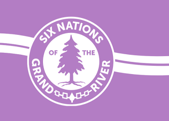
Today, less than 5% of the Haldimand Tract is currently owned by the Haudenosaunee. The remaining land is found on the Six Nations of the Grand River reserve, which is located near Brantford, Ontario. The Six Nations of the Grand River continue to investigate land transactions on the Haldimand Tract and seek fair compensation from the Canadian government. [22]
The history of Waterloo and the many people who have lived on this land is rich, yet complex. By exploring the stories of our past, we can begin to understand our present.
If you would like to learn more about Waterloo’s history, please visit the Ellis Little Local History Room at the Main Library or check out the Waterloo Public Library’s online collections here.
For further reading check out...
- The Canadian Encyclopedia to read more about the Haldimand Proclamation.
- The Six Nations of the Grand River’s Key Issues and Land Resources webpages to read more about Indigenous land rights.
- The Valley of the Six Nations edited by Charles M. Johnston for primary documents, including transcriptions of letters and treaties.
- Waterloo Township Through Two Centuries by Elizabeth Bloomfield to read more about early settlers in Waterloo Region.
- Noble, William C. “The Neutral Confederacy.” Canadian Encyclopedia, Historica Canada, 14 March 2016, www.thecanadianencyclopedia.ca/en/article/neutral.
- Weidner, Johanna. “Pottery shards, stone tools among Indigenous artifacts found on Kitchener site.” The Record, 4 March 2020, https://www.therecord.com/news/waterloo-region/2020/03/04/pottery-shards-stone-tools-among-indigenous-artifacts-found-on-kitchener-site.html
- Noble, William C. “The Neutral Confederacy.” Canadian Encyclopedia, Historica Canada, 14 March 2016, www.thecanadianencyclopedia.ca/en/article/neutral.
- McLaughlin, Kenneth and Murray G. Brooksbank. Preserving our Past: the Ormston Heritage House: a window into Waterloo Township’s history. 2020. pg. 11-13
- Glover, Fred. “Royal Proclamation of 1763 (Plain-Language Summary).” Canadian Encyclopedia, Historica Canada, 3 February 2020, https://www.thecanadianencyclopedia.ca/en/article/royal-proclamation-of-1763-plain-language-summary .
- “Six Miles Deep: Land Rights of the Six Nations of the Grand River.” Six Nations Council, https://www.sixnations.ca/SixMilesDeepBooklet2015Final.pdf . pg. 4
- Rickert-Hall, Joanna. Waterloo You Never Knew: Life on the Margins. Dundurn Press, 2019. pg. 24
- Johnston, Charles M., editor. The Valley of the Six Nations. University of Toronto Press, 1964. pg. 48
- Johnston, Charles M., editor. The Valley of the Six Nations. University of Toronto Press, 1964. pg. 47
- “Key Issues: Lands & Resources.” Six Nations of the Grand River, 2021, https://www.sixnations.ca/key-issues/land-rights
- “The Haldimand Treaty of 1784.” Six Nations Council, 2008, https://www.sixnations.ca/LandsResources/HaldProc.htm .
- Filice, Michelle. “Haldimand Proclamation.” Canadian Encyclopedia, Historica Canada, 10 November 2020, https://www.thecanadianencyclopedia.ca/en/article/haldimand-proclamation .
- Cruikshank, E.A.. “The Reserve of the Six Nations on the Grand River and the Mennonite Purchase of Block No. 2.” Waterloo Historical Society, vol. 15, 1927. pg. 312
- McLaughlin, Kenneth and Murray G. Brooksbank. Preserving our Past: the Ormston Heritage House: a window into Waterloo Township’s history. 2020. pg. 19
- Filice, Michelle. “Haldimand Proclamation.” Canadian Encyclopedia, Historica Canada, 10 November 2020, https://www.thecanadianencyclopedia.ca/en/article/haldimand-proclamation .
- McLaughlin, Kenneth and Murray G. Brooksbank. Preserving our Past: the Ormston Heritage House: a window into Waterloo Township’s history. 2020. pg. 19-21
- Bloomfield, Elizabeth. Waterloo Township through Two Centuries. 1995. pg. 34
- Rowell, Marg, Ed Devitt and Pat McKegney. Welcome to Waterloo. 1982. pg. 8-9
- “Six Miles Deep: Land Rights of the Six Nations of the Grand River.” Six Nations Council, https://www.sixnations.ca/SixMilesDeepBooklet2015Final.pdf . pg. 5
- Rickert-Hall, Joanna. Waterloo You Never Knew: Life on the Margins. Dundurn Press, 2019. pg. 27
- Rowell, Marg, Ed Devitt and Pat McKegney. Welcome to Waterloo. 1982. pg. 9
- “Key Issues: Lands & Resources.” Six Nations of the Grand River, 2021, https://www.sixnations.ca/key-issues/land-rights